
View 360° Video and Imagery of Your Local Shorelines
Without Leaving the Office
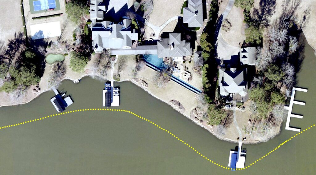
Our 360° shoreline imagery allows for comprehensive
review of lakefront property conditions, dock and boat
numbers, seawall conditions, and more — all from
your computer.
View Our Data in Video Mode
0:00
-1:00
View Our Data in Picture Mode
❮ Prev
Next ❯
1/6
- Every picture is geotagged so you know exactly where it was taken from
- Points delivered in shapefile and/or geodatabase format
Features of ShoreView360's Imagery
- Access to seamless, 360° panoramic views of shorelines
- Online and offline viewing options
- Local copies available for offline viewing
- Local copies contain NO intentional blurring
- Delivery in 360 video and 360 picture formats
- Coorindates imbedded into each video and image
- Seamless integration of images with existing GIS data layers
- Each image available via point shapefiles and hyperlink functionality
- Images publicly accessible via Google's Street View® application (optional)
- Google automatically applies blurring algorithm to online files (good thing)
- Captured in 8K resolution at 5 frames per second
- Project scope scalable to meet your budget
Useful For:
- Verification of dock numbers and boat numbers, when visible
- Verifying conditions of seawalls, docks, and other shoreline improvements
- Viewing rear of house and inspect for addtions or improvements
- Clearly viewing mechanical improvements such as lifts
- Viewing water depth at docksides (optional)
- Assessing quality of view from dockside
- Residents and prospective buyers can take virtual boat tours from home
- Assessing ShoreView appeal
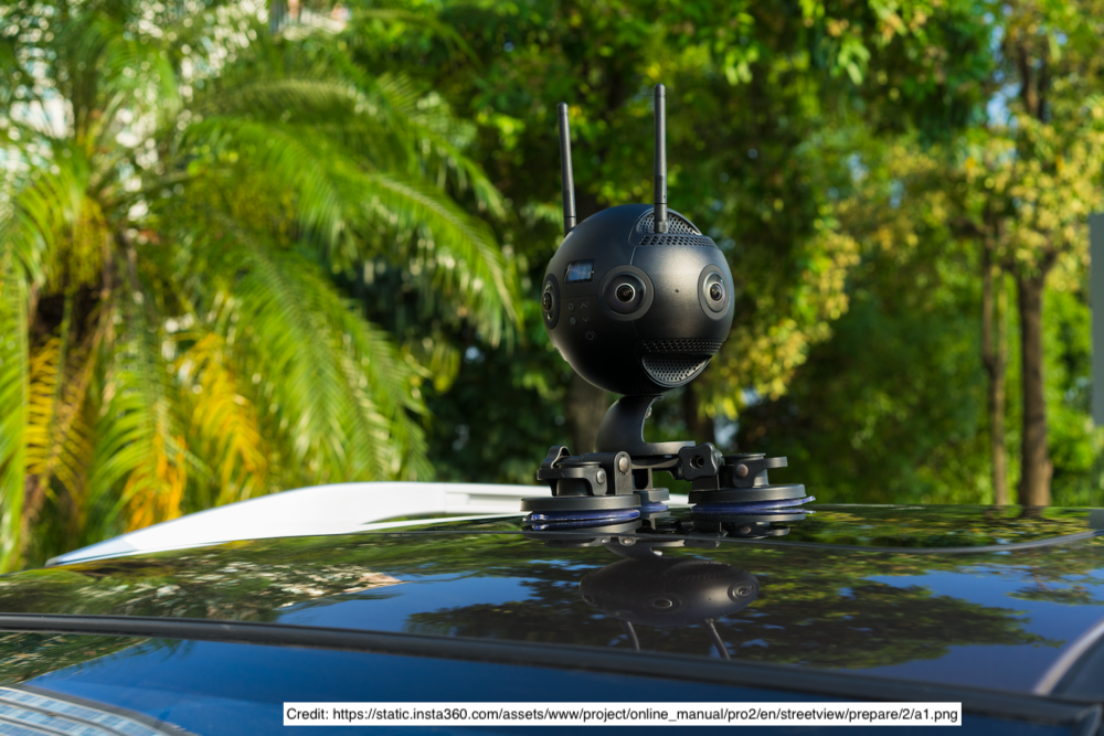
About Our Camera System
- Mounted on telescoping pole leveled with gimbal system
- 6 lenses, simultaneous capture, 360° coverage
- Built-in GPS with external antenna
- Video capture, delivered as video or pictures
Copyright © 2026 ShoreView360. All rights reserved.